 vesseltracker.com
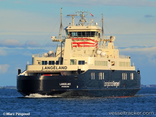
 Langeland
Current Status
Where is the vessel?
Langeland is currently in Near SPODSBJERG, based on AIS data received about 2h ago.
Latest AIS update:
Current position: 54.93490° N, 10.83397° E (Near SPODSBJERG)
Average speed (last 7 days): Loading…
Average speed (last 30 days): Loading…
Vessel profile: Langeland is a Passenger Ro Ro Cargo Ship with dimensions 98m x 18m.
This page combines live AIS, route history, probable destination signals, nearby traffic, and port activity for practical vessel monitoring.
The current position of vessel Langeland is 54.93490 lat / 10.83397 lng. Updated: 2026-05-15 01:15:48 UTCNearest reference points:
- Near SPODSBJERG
- Near RUDKOBING
- Near Lundeborg
Currently sailing under the flag of Denmark ![]()
Langeland built in 2012 year
Deadweight:
972 tDetails:
Live Vessel Langeland Analytics (details, animations, etc.)
Recent AIS points (UTC):
2026-05-14 22:01:08 UTC · 54.93488, 10.83398 · SOG 0 kn · COG 106°2026-05-14 22:37:27 UTC · 54.93488, 10.83400 · SOG 0 kn · COG 106°
2026-05-14 23:58:57 UTC · 54.93488, 10.83398 · SOG 0 kn · COG 106°
2026-05-15 01:15:48 UTC · 54.93490, 10.83397 · SOG 0 kn · COG 106°