 vesseltracker.com
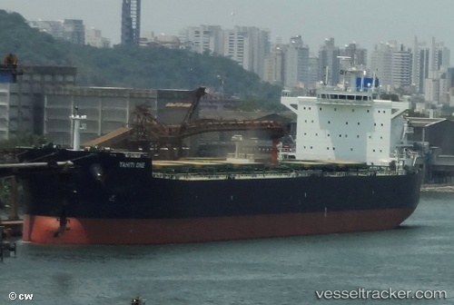
Tahiti One
Current StatusWhere is the vessel?
Tahiti One is currently in Near PENGERANG, based on AIS data received less than 1h ago.
Latest AIS update:
Current position: 1.33102° N, 104.33778° E (Near PENGERANG)
Average speed (last 7 days): Loading…
Average speed (last 30 days): Loading…
Vessel profile: Tahiti One is a Bulk Carrier with dimensions 32m x 229m.
This page combines live AIS, route history, probable destination signals, nearby traffic, and port activity for practical vessel monitoring.
The current position of vessel Tahiti One is 1.33102 lat / 104.33778 lng. Updated: 2026-05-14 16:58:50 UTCNearest reference points:
- Near PENGERANG
- Near Tanjung Setapa
- Near TANAH MERAH
Details:
Live Vessel Tahiti One Analytics (details, animations, etc.)
Recent AIS points (UTC):
2026-05-14 13:29:11 UTC · 1.60054, 104.76527 · SOG 9.1 kn · COG 277°2026-05-14 14:21:59 UTC · 1.55048, 104.64584 · SOG 8.8 kn · COG 238°
2026-05-14 15:38:29 UTC · 1.44942, 104.48901 · SOG 8.7 kn · COG 237°
2026-05-14 16:58:50 UTC · 1.33102, 104.33778 · SOG 7.8 kn · COG 229°