 vesseltracker.com
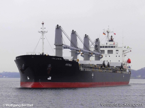
 PETRA
PETRA
Current Status
Where is the vessel?
PETRA is currently in 87 nm SW of Puerto Edén, based on AIS data received less than 1h ago.
Latest AIS update:
Current position: 50.30299° S, 75.82807° W (87 nm SW of Puerto Edén)
Average speed (last 7 days): Loading…
Average speed (last 30 days): Loading…
Vessel profile: PETRA is a General Cargo Ship with dimensions 29m x 180m.
This page combines live AIS, route history, probable destination signals, nearby traffic, and port activity for practical vessel monitoring.
The current position of vessel PETRA is -50.30299 lat / -75.82807 lng. Updated: 2026-05-14 19:46:22 UTCCurrently sailing under the flag of Marshall Islands ![]()
PETRA built in 2011 year
Deadweight:
33688 tDetails:
Live Vessel PETRA Analytics (details, animations, etc.)
Recent AIS points (UTC):
2026-05-14 16:48:47 UTC · -49.78873, -75.89256 · SOG 11.1 kn · COG 180°2026-05-14 18:05:58 UTC · -50.01743, -75.87140 · SOG 11.2 kn · COG 176°
2026-05-14 19:30:34 UTC · -50.25747, -75.83348 · SOG 10.2 kn · COG 182°
2026-05-14 19:46:22 UTC · -50.30299, -75.82807 · SOG 9.9 kn · COG 180°