 vesseltracker.com
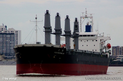
 Aquamarine Sw
Current Status
Where is the vessel?
Aquamarine Sw is currently in Near Colon, based on AIS data received less than 1h ago.
Latest AIS update:
Current position: 9.41732° N, 79.93788° W (Near Colon)
Average speed (last 7 days): Loading…
Average speed (last 30 days): Loading…
Vessel profile: Aquamarine Sw is a Bulk Carrier with dimensions 178m x 29m.
This page combines live AIS, route history, probable destination signals, nearby traffic, and port activity for practical vessel monitoring.
The current position of vessel Aquamarine Sw is 9.41732 lat / -79.93788 lng. Updated: 2026-05-02 09:23:18 UTCNearest reference points:
- Near Colon
- Near COLON 2000
- Near Colón Free Zone
Currently sailing under the flag of Panama ![]()
Aquamarine Sw built in 2012 year
Deadweight:
37119 tDetails:
Live Vessel Aquamarine Sw Analytics (details, animations, etc.)
Recent AIS points (UTC):
2026-05-02 06:23:40 UTC · 9.41734, -79.93773 · SOG 0 kn · COG 248°2026-05-02 07:22:38 UTC · 9.41744, -79.93782 · SOG 0.1 kn · COG 244°
2026-05-02 07:53:58 UTC · 9.41721, -79.93778 · SOG 0.1 kn · COG 258°
2026-05-02 09:23:18 UTC · 9.41732, -79.93788 · SOG 0 kn · COG 255°