 vesseltracker.com
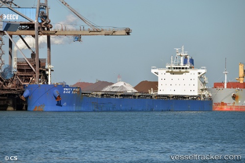
 Syros I
Current Status
Where is the vessel?
Syros I is currently in Near Ponta da Madeira, based on AIS data received less than 1h ago.
Latest AIS update:
Current position: 2.57464° S, 44.37141° W (Near Ponta da Madeira)
Average speed (last 7 days): Loading…
Average speed (last 30 days): Loading…
Vessel profile: Syros I is a Bulk Carrier with dimensions 229m x 33m.
This page combines live AIS, route history, probable destination signals, nearby traffic, and port activity for practical vessel monitoring.
The current position of vessel Syros I is -2.57464 lat / -44.37141 lng. Updated: 2026-05-17 11:01:28 UTCNearest reference points:
- 53 nm N of Beija-Flor
Currently sailing under the flag of Liberia ![]()
Syros I built in 2011 year
Deadweight:
81393 tDetails:
Live Vessel Syros I Analytics (details, animations, etc.)
Recent AIS points (UTC):
2026-05-17 07:52:24 UTC · -2.57469, -44.37140 · SOG 0 kn · COG 325°2026-05-17 07:55:26 UTC · -2.57466, -44.37140 · SOG 0 kn · COG 325°
2026-05-17 09:22:23 UTC · -2.57467, -44.37139 · SOG 0 kn · COG 325°
2026-05-17 11:01:28 UTC · -2.57464, -44.37141 · SOG 0 kn · COG 325°