 vesseltracker.com
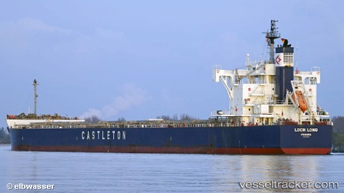
Loch Long
Current StatusWhere is the vessel?
Loch Long is currently in 370 nm N of Ramalde, based on AIS data received less than 1h ago.
Latest AIS update:
Current position: 35.19833° S, 6.66667° W (370 nm N of Ramalde)
Average speed (last 7 days): Loading…
Average speed (last 30 days): Loading…
Vessel profile: Loch Long is a Bulk Carrier with dimensions 32m x 230m.
This page combines live AIS, route history, probable destination signals, nearby traffic, and port activity for practical vessel monitoring.
The current position of vessel Loch Long is -35.19833 lat / -6.66667 lng. Updated: 2026-04-29 22:30:12 UTCNearest reference points:
- Open sea, approx. 401 nm off the nearest listed port
- Open sea, approx. 407 nm off the nearest listed port
- Open sea, approx. 409 nm off the nearest listed port
Details:
Live Vessel Loch Long Analytics (details, animations, etc.)
Recent AIS points (UTC):
2026-04-29 19:29:31 UTC · -35.13063, -7.36127 · SOG 11.1 kn · COG 95°2026-04-29 20:13:03 UTC · -35.14575, -7.19483 · SOG 11.4 kn · COG 96°
2026-04-29 21:39:20 UTC · -35.18027, -6.86408 · SOG 11.4 kn · COG 95°
2026-04-29 22:30:12 UTC · -35.19833, -6.66667 · SOG 11 kn · COG -1°