 vesseltracker.com
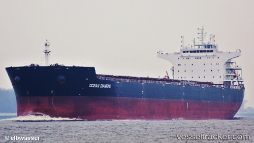
 HONG G
Current Status
Where is the vessel?
HONG G is currently in 33 nm NW of Estombar, based on AIS data received less than 1h ago.
Latest AIS update:
Current position: 37.57167° N, 8.04667° E (33 nm NW of Estombar)
Average speed (last 7 days): Loading…
Average speed (last 30 days): Loading…
Vessel profile: HONG G is a Bulk Carrier with dimensions 229m x 229m.
This page combines live AIS, route history, probable destination signals, nearby traffic, and port activity for practical vessel monitoring.
The current position of vessel HONG G is 37.57167 lat / 8.04667 lng. Updated: 2026-05-15 21:43:02 UTCNearest reference points:
- Near Annaba
- 35 nm S of Setubal
- 33 nm SE of Setubal
Currently sailing under the flag of Liberia ![]()
HONG G built in 2012 year
Deadweight:
93025 tDetails:
Live Vessel HONG G Analytics (details, animations, etc.)
Recent AIS points (UTC):
2026-05-15 17:52:01 UTC · 37.52167, 7.24667 · SOG 9 kn · COG -1°2026-05-15 19:07:02 UTC · 37.53667, 7.50500 · SOG 9 kn · COG -1°
2026-05-15 19:52:04 UTC · 37.54667, 7.65833 · SOG 9 kn · COG -1°
2026-05-15 21:43:02 UTC · 37.57167, 8.04667 · SOG 10 kn · COG -1°