 vesseltracker.com
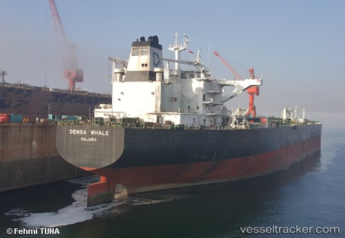
 SEAMAJESTY
Current Status
Where is the vessel?
SEAMAJESTY is currently in 75 nm N of Darnah, based on AIS data received less than 1h ago.
Latest AIS update:
Current position: 33.96500° N, 23.04833° E (75 nm N of Darnah)
Average speed (last 7 days): Loading…
Average speed (last 30 days): Loading…
Vessel profile: SEAMAJESTY is a Crude Oil Tanker with dimensions 274m x 274m.
This page combines live AIS, route history, probable destination signals, nearby traffic, and port activity for practical vessel monitoring.
The current position of vessel SEAMAJESTY is 33.96500 lat / 23.04833 lng. Updated: 2026-05-14 21:23:45 UTCNearest reference points:
- 59 nm W of Paleochora
- 85 nm W of Paleochora
- 67 nm S of Kali Limenes
Currently sailing under the flag of Malta ![]()
SEAMAJESTY built in 2012 year
Deadweight:
158322 tDetails:
Live Vessel SEAMAJESTY Analytics (details, animations, etc.)
Recent AIS points (UTC):
2026-05-14 17:53:53 UTC · 33.62833, 23.81500 · SOG 12 kn · COG -1°2026-05-14 19:11:47 UTC · 33.75167, 23.53667 · SOG 12 kn · COG -1°
2026-05-14 19:47:06 UTC · 33.80929, 23.40961 · SOG 12.4 kn · COG 298°
2026-05-14 21:23:45 UTC · 33.96500, 23.04833 · SOG 12 kn · COG -1°