 vesseltracker.com
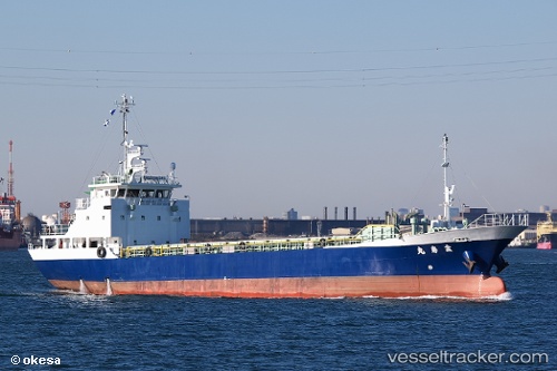
 Kinjyu Maru
Current Status
Where is the vessel?
Kinjyu Maru is currently in 12 nm S of HIKARI, based on AIS data received less than 1h ago.
Latest AIS update:
Current position: 33.76100° N, 131.99435° E (12 nm S of HIKARI)
Average speed (last 7 days): Loading…
Average speed (last 30 days): Loading…
Vessel profile: Kinjyu Maru is a General Cargo Ship with dimensions 59m x 10m.
This page combines live AIS, route history, probable destination signals, nearby traffic, and port activity for practical vessel monitoring.
The current position of vessel Kinjyu Maru is 33.76100 lat / 131.99435 lng. Updated: 2026-05-17 13:55:34 UTCNearest reference points:
- 13 nm SE of HIKARI
- 14 nm SE of HIKARI
- 18 nm SE of HIKARI
Currently sailing under the flag of Japan ![]()
Kinjyu Maru built in 2010 year
Deadweight:
800 tDetails:
Live Vessel Kinjyu Maru Analytics (details, animations, etc.)
Recent AIS points (UTC):
2026-05-17 10:27:34 UTC · 33.94552, 132.52364 · SOG 7.5 kn · COG 244°2026-05-17 11:23:18 UTC · 33.86780, 132.41048 · SOG 7.9 kn · COG 227°
2026-05-17 13:49:55 UTC · 33.76253, 132.01180 · SOG 9.1 kn · COG 266°
2026-05-17 13:55:34 UTC · 33.76100, 131.99435 · SOG 9.3 kn · COG 265°