 vesseltracker.com
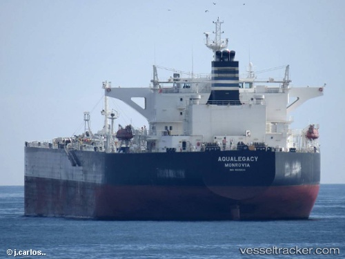
Aqualegacy
Current StatusWhere is the vessel?
Aqualegacy is currently in 135 nm NE of Margonin, based on AIS data received less than 1h ago.
Latest AIS update:
Current position: 54.20754° N, 179.15475° E (135 nm NE of Margonin)
Average speed (last 7 days): Loading…
Average speed (last 30 days): Loading…
Vessel profile: Aqualegacy is a Crude Oil Tanker with dimensions 44m x 249m.
This page combines live AIS, route history, probable destination signals, nearby traffic, and port activity for practical vessel monitoring.
The current position of vessel Aqualegacy is 54.20754 lat / 179.15475 lng. Updated: 2026-05-15 10:30:33 UTCNearest reference points:
- 87 nm NE of Margonin
Details:
Live Vessel Aqualegacy Analytics (details, animations, etc.)
Recent AIS points (UTC):
2026-05-15 07:23:24 UTC · 54.22500, -179.70634 · SOG 12.5 kn · COG 270°2026-05-15 07:48:43 UTC · 54.22488, -179.85809 · SOG 12.6 kn · COG 270°
2026-05-15 09:22:32 UTC · 54.21523, 179.56908 · SOG 12.9 kn · COG 267°
2026-05-15 10:30:33 UTC · 54.20754, 179.15475 · SOG 12.8 kn · COG 267°