 vesseltracker.com
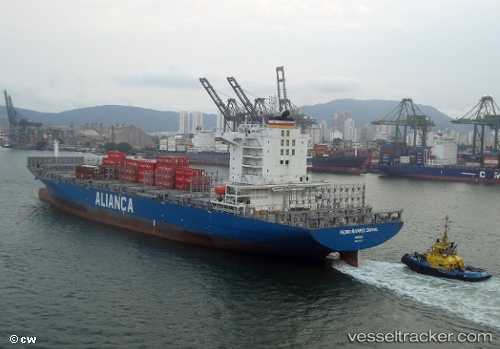
 Pedro Alvares Cabral
Current Status
Where is the vessel?
Pedro Alvares Cabral is currently in 12 nm E of Almeirim, based on AIS data received about 2h ago.
Latest AIS update:
Current position: 1.56667° S, 52.38167° W (12 nm E of Almeirim)
Average speed (last 7 days): Loading…
Average speed (last 30 days): Loading…
Vessel profile: Pedro Alvares Cabral is a Container Ship with dimensions 228m x 38m.
This page combines live AIS, route history, probable destination signals, nearby traffic, and port activity for practical vessel monitoring.
The current position of vessel Pedro Alvares Cabral is -1.56667 lat / -52.38167 lng. Updated: 2026-05-13 19:40:52 UTCNearest reference points:
- Near Santana
- 15 nm NW of SANTAREM
- 55 nm N of Tucuma
Currently sailing under the flag of Brazil ![]()
Pedro Alvares Cabral built in 2013 year
Deadweight:
52019 tDetails:
Live Vessel Pedro Alvares Cabral Analytics (details, animations, etc.)
Recent AIS points (UTC):
2026-05-13 16:52:51 UTC · -1.75333, -53.24500 · SOG 20 kn · COG -1°2026-05-13 17:10:57 UTC · -1.75667, -53.14500 · SOG 20 kn · COG -1°
2026-05-13 19:34:52 UTC · -1.57333, -52.41167 · SOG 19 kn · COG -1°
2026-05-13 19:40:52 UTC · -1.56667, -52.38167 · SOG 19 kn · COG -1°