 vesseltracker.com
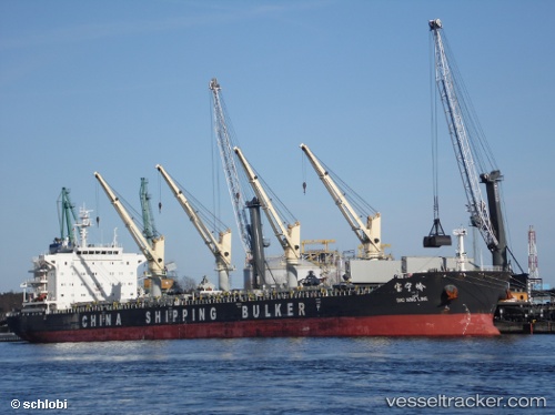
 Bao Ning Ling
Current Status
Where is the vessel?
Bao Ning Ling is currently in Near Tanjung Perak, based on AIS data received about 4h ago.
Latest AIS update:
Current position: 7.19667° S, 112.72500° E (Near Tanjung Perak)
Average speed (last 7 days): Loading…
Average speed (last 30 days): Loading…
Vessel profile: Bao Ning Ling is a Bulk Carrier with dimensions 189m x 32m.
This page combines live AIS, route history, probable destination signals, nearby traffic, and port activity for practical vessel monitoring.
The current position of vessel Bao Ning Ling is -7.19667 lat / 112.72500 lng. Updated: 2026-05-14 23:43:38 UTCNearest reference points:
- Near Tanjung Perak
- Near Tanjong Perak
- Near Kalianak Barat
Currently sailing under the flag of China ![]()
Details:
Live Vessel Bao Ning Ling Analytics (details, animations, etc.)
Recent AIS points (UTC):
2026-05-14 20:15:51 UTC · -7.19754, 112.72574 · SOG 0 kn · COG 81°2026-05-14 22:12:53 UTC · -7.19752, 112.72577 · SOG 0 kn · COG 81°
2026-05-14 22:27:52 UTC · -7.19753, 112.72576 · SOG 0 kn · COG 81°
2026-05-14 23:43:38 UTC · -7.19667, 112.72500 · SOG 0 kn · COG -1°