 vesseltracker.com
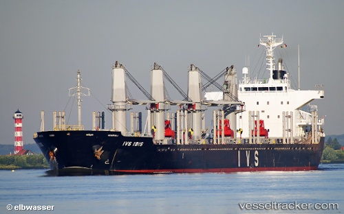
 LADY MARY
Current Status
Where is the vessel?
LADY MARY is currently in Near Las Palmas de Gran Canaria, based on AIS data received less than 1h ago.
Latest AIS update:
Current position: 28.07224° N, 15.39745° W (Near Las Palmas de Gran Canaria)
Average speed (last 7 days): Loading…
Average speed (last 30 days): Loading…
Vessel profile: LADY MARY is a Bulk Carrier with dimensions m x m.
This page combines live AIS, route history, probable destination signals, nearby traffic, and port activity for practical vessel monitoring.
The current position of vessel LADY MARY is 28.07224 lat / -15.39745 lng. Updated: 2026-04-23 17:19:45 UTCNearest reference points:
- Near Las Palmas de Gran Canaria
- Near Las Palmas
- Near TALIARTE
Currently sailing under the flag of Barbados ![]()
Details:
Live Vessel LADY MARY Analytics (details, animations, etc.)
Recent AIS points (UTC):
2026-04-23 14:14:36 UTC · 28.07352, -15.39773 · SOG 0 kn · COG -1°2026-04-23 16:04:43 UTC · 28.07239, -15.39753 · SOG 0 kn · COG 51°
2026-04-23 16:37:42 UTC · 28.07233, -15.39745 · SOG 0.1 kn · COG 53°
2026-04-23 17:19:45 UTC · 28.07224, -15.39745 · SOG 0.2 kn · COG 49°