 vesseltracker.com
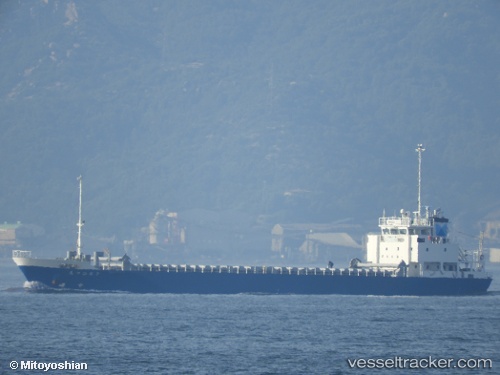
Mituhiro7
Current StatusWhere is the vessel?
Mituhiro7 is currently in Near SHICHIRUI, based on AIS data received less than 1h ago.
Latest AIS update:
Current position: 35.65515° N, 133.18077° E (Near SHICHIRUI)
Average speed (last 7 days): Loading…
Average speed (last 30 days): Loading…
Vessel profile: Mituhiro7 is a General Cargo Ship with dimensions 12m x 75m.
This page combines live AIS, route history, probable destination signals, nearby traffic, and port activity for practical vessel monitoring.
The current position of vessel Mituhiro7 is 35.65515 lat / 133.18077 lng. Updated: 2026-05-14 11:59:42 UTCNearest reference points:
- 37 nm NW of NAKANOSHIMA
- 15 nm NW of SHIMONOHAMA
- Near FUKUYAMA
Details:
Live Vessel Mituhiro7 Analytics (details, animations, etc.)
Recent AIS points (UTC):
2026-05-14 07:51:51 UTC · 35.84667, 134.23167 · SOG 12 kn · COG -1°2026-05-14 10:27:32 UTC · 35.72570, 133.58047 · SOG 12.7 kn · COG 258°
2026-05-14 11:02:53 UTC · 35.69860, 133.42644 · SOG 13.1 kn · COG 257°
2026-05-14 11:59:42 UTC · 35.65515, 133.18077 · SOG 12.8 kn · COG 256°