 vesseltracker.com
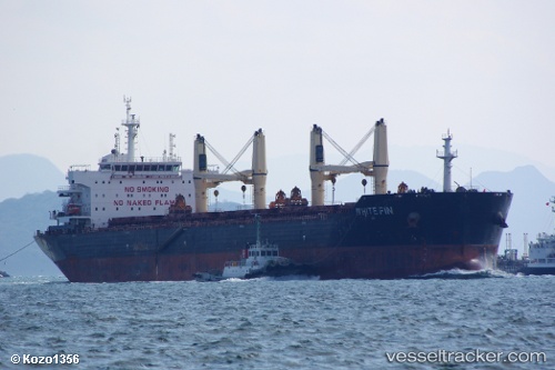
White Fin
Current StatusWhere is the vessel?
White Fin is currently in Near Rufisque, based on AIS data received less than 1h ago.
Latest AIS update:
Current position: 14.57500° N, 17.33167° W (Near Rufisque)
Average speed (last 7 days): Loading…
Average speed (last 30 days): Loading…
Vessel profile: White Fin is a Bulk Carrier with dimensions 23m x 190m.
This page combines live AIS, route history, probable destination signals, nearby traffic, and port activity for practical vessel monitoring.
The current position of vessel White Fin is 14.57500 lat / -17.33167 lng. Updated: 2026-05-14 11:28:37 UTCNearest reference points:
- Near Rufisque
- Near Dakar
- Near Banjul
Details:
Live Vessel White Fin Analytics (details, animations, etc.)
Recent AIS points (UTC):
2026-05-14 07:22:39 UTC · 14.57667, -17.33000 · SOG 0 kn · COG -1°2026-05-14 09:39:56 UTC · 14.57654, -17.33187 · SOG 0 kn · COG 343°
2026-05-14 10:36:51 UTC · 14.57640, -17.33193 · SOG 0.1 kn · COG 342°
2026-05-14 11:28:37 UTC · 14.57500, -17.33167 · SOG 0 kn · COG -1°