 vesseltracker.com
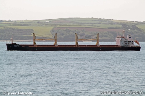
 Red Fin
Current Status
Where is the vessel?
Red Fin is currently in 14 nm NE of VISTINO, based on AIS data received about 1h ago.
Latest AIS update:
Current position: 59.98806° N, 28.64557° E (14 nm NE of VISTINO)
Average speed (last 7 days): Loading…
Average speed (last 30 days): Loading…
Vessel profile: Red Fin is a Bulk Carrier with dimensions 190m x 190m.
This page combines live AIS, route history, probable destination signals, nearby traffic, and port activity for practical vessel monitoring.
The current position of vessel Red Fin is 59.98806 lat / 28.64557 lng. Updated: 2026-04-24 16:37:56 UTCNearest reference points:
- 11 nm NE of VISTINO
- 10 nm NE of VISTINO
- Near VISTINO
Currently sailing under the flag of Malta ![]()
Red Fin built in 2011 year
Deadweight:
56780 tDetails:
Live Vessel Red Fin Analytics (details, animations, etc.)
Recent AIS points (UTC):
2026-04-24 14:07:19 UTC · 59.99244, 28.64055 · SOG 0.2 kn · COG 282°2026-04-24 16:20:28 UTC · 59.98785, 28.64519 · SOG 0.7 kn · COG 239°
2026-04-24 16:20:28 UTC · 59.98785, 28.64519 · SOG 0.7 kn · COG 239°
2026-04-24 16:37:56 UTC · 59.98806, 28.64557 · SOG 0.7 kn · COG 205°