 vesseltracker.com
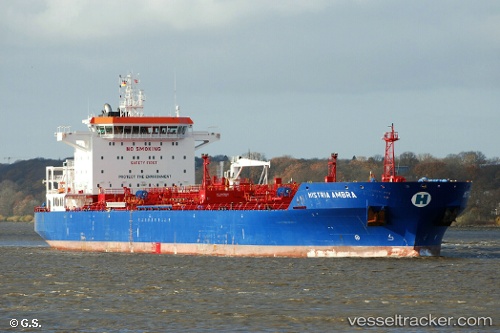
 Histria Ambra
Current Status
Where is the vessel?
Histria Ambra is currently in 45 nm SE of Bova Marina, based on AIS data received less than 1h ago.
Latest AIS update:
Current position: 37.42311° N, 16.61772° E (45 nm SE of Bova Marina)
Average speed (last 7 days): Loading…
Average speed (last 30 days): Loading…
Vessel profile: Histria Ambra is a Chemical Oil Products Tanker with dimensions 180m x 32m.
This page combines live AIS, route history, probable destination signals, nearby traffic, and port activity for practical vessel monitoring.
The current position of vessel Histria Ambra is 37.42311 lat / 16.61772 lng. Updated: 2026-04-12 10:44:35 UTCNearest reference points:
- 24 nm SE of Bianco
- 29 nm E of Licodia Eubea
- 34 nm NE of Villafranca Tirrena
Currently sailing under the flag of Liberia ![]()
Histria Ambra built in 2013 year
Deadweight:
40345 tDetails:
Live Vessel Histria Ambra Analytics (details, animations, etc.)
Recent AIS points (UTC):
2026-04-10 04:02:13 UTC · 32.63277, 26.57547 · SOG 10.3 kn · COG -1°2026-04-12 07:17:56 UTC · 37.12044, 17.29765 · SOG 11.1 kn · COG 293°
2026-04-12 08:10:05 UTC · 37.19433, 17.12171 · SOG 11.1 kn · COG 298°
2026-04-12 10:44:35 UTC · 37.42311, 16.61772 · SOG 11 kn · COG 299°