 vesseltracker.com
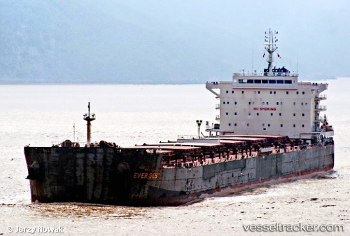
 Ever Best
Current Status
Where is the vessel?
Ever Best is currently in 113 nm E of Fort Dauphin, based on AIS data received about 1h ago.
Latest AIS update:
Current position: 24.47823° S, 48.99874° E (113 nm E of Fort Dauphin)
Average speed (last 7 days): Loading…
Average speed (last 30 days): Loading…
Vessel profile: Ever Best is a Bulk Carrier with dimensions 229m x 32m.
This page combines live AIS, route history, probable destination signals, nearby traffic, and port activity for practical vessel monitoring.
The current position of vessel Ever Best is -24.47823 lat / 48.99874 lng. Updated: 2026-05-13 19:49:26 UTCNearest reference points:
- 194 nm E of Manakara
Currently sailing under the flag of Panama ![]()
Details:
Live Vessel Ever Best Analytics (details, animations, etc.)
Recent AIS points (UTC):
2026-05-13 16:41:36 UTC · -24.08504, 49.57196 · SOG 12.8 kn · COG 235°2026-05-13 18:24:57 UTC · -24.29855, 49.25698 · SOG 12.6 kn · COG 231°
2026-05-13 19:41:27 UTC · -24.46144, 49.02355 · SOG 12.6 kn · COG 232°
2026-05-13 19:49:26 UTC · -24.47823, 48.99874 · SOG 12.7 kn · COG 232°