 vesseltracker.com
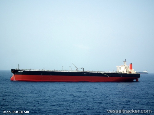
 Horaisan
Current Status
Where is the vessel?
Horaisan is currently in 134 nm SW of Juazeiro-Pi, based on AIS data received less than 1h ago.
Latest AIS update:
Current position: 3.42212° N, 43.10905° W (134 nm SW of Juazeiro-Pi)
Average speed (last 7 days): Loading…
Average speed (last 30 days): Loading…
Vessel profile: Horaisan is a Crude Oil Tanker with dimensions 333m x 60m.
This page combines live AIS, route history, probable destination signals, nearby traffic, and port activity for practical vessel monitoring.
The current position of vessel Horaisan is 3.42212 lat / -43.10905 lng. Updated: 2026-05-15 05:28:39 UTCNearest reference points:
- 223 nm SW of Juazeiro-Pi
- 227 nm W of Juazeiro-Pi
Currently sailing under the flag of Japan ![]()
Horaisan built in 2013 year
Deadweight:
305301 tDetails:
Live Vessel Horaisan Analytics (details, animations, etc.)
Recent AIS points (UTC):
2026-05-14 23:51:45 UTC · 4.17261, -44.30053 · SOG 14.5 kn · COG 120°2026-05-15 03:26:34 UTC · 3.70182, -43.53838 · SOG 14.8 kn · COG 127°
2026-05-15 04:50:33 UTC · 3.50796, -43.24433 · SOG 15.1 kn · COG 125°
2026-05-15 05:28:39 UTC · 3.42212, -43.10905 · SOG 15 kn · COG 124°