 vesseltracker.com
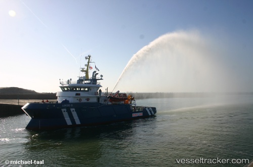
Glomar Linde
Current StatusWhere is the vessel?
Glomar Linde is currently in 40 nm SW of Neeltje Jans, based on AIS data received less than 1h ago.
Latest AIS update:
Current position: 53.19333° N, 2.86667° E (40 nm SW of Neeltje Jans)
Average speed (last 7 days): Loading…
Average speed (last 30 days): Loading…
Vessel profile: Glomar Linde is a Standby Safety Vessel with dimensions 11m x 42m.
This page combines live AIS, route history, probable destination signals, nearby traffic, and port activity for practical vessel monitoring.
The current position of vessel Glomar Linde is 53.19333 lat / 2.86667 lng. Updated: 2026-05-14 08:11:41 UTCNearest reference points:
- 24 nm NE of Caister on Sea
- Near Craven Arms
- 19 nm NW of Neeltje Jans
Details:
Live Vessel Glomar Linde Analytics (details, animations, etc.)
Recent AIS points (UTC):
2026-05-14 04:20:42 UTC · 53.15333, 2.92667 · SOG 1 kn · COG -1°2026-05-14 05:41:42 UTC · 53.18833, 2.87500 · SOG 1 kn · COG -1°
2026-05-14 07:23:42 UTC · 53.18833, 2.87167 · SOG 1 kn · COG -1°
2026-05-14 08:11:41 UTC · 53.19333, 2.86667 · SOG 0 kn · COG -1°