 vesseltracker.com
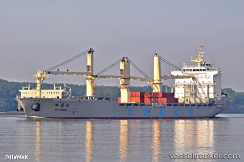
Ru Yi Song
Current StatusWhere is the vessel?
Ru Yi Song is currently in Near ZHANJIANG, based on AIS data received less than 1h ago.
Latest AIS update:
Current position: 21.29130° N, 110.41648° E (Near ZHANJIANG)
Average speed (last 7 days): Loading…
Average speed (last 30 days): Loading…
Vessel profile: Ru Yi Song is a Multi Purpose Carrier with dimensions 27m x 180m.
This page combines live AIS, route history, probable destination signals, nearby traffic, and port activity for practical vessel monitoring.
The current position of vessel Ru Yi Song is 21.29130 lat / 110.41648 lng. Updated: 2026-05-15 08:21:54 UTCNearest reference points:
- Near Zhanjiang Pt
- Near Wuchuan
- Near Naozhou
Details:
Live Vessel Ru Yi Song Analytics (details, animations, etc.)
Recent AIS points (UTC):
2026-05-15 04:18:48 UTC · 21.29126, 110.41641 · SOG 0 kn · COG 359°2026-05-15 06:06:56 UTC · 21.29123, 110.41644 · SOG 0 kn · COG 359°
2026-05-15 07:57:52 UTC · 21.29123, 110.41642 · SOG 0 kn · COG 359°
2026-05-15 08:21:54 UTC · 21.29130, 110.41648 · SOG 0 kn · COG 359°