 vesseltracker.com
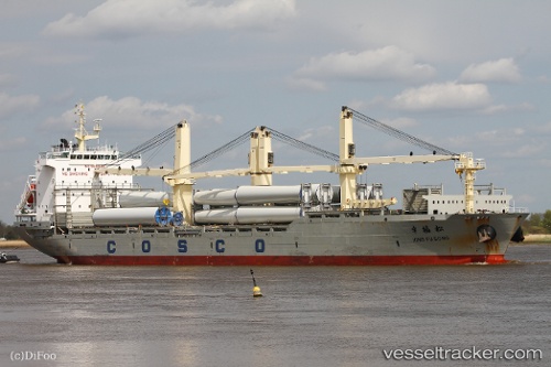
Xing Fu Song
Current StatusWhere is the vessel?
Xing Fu Song is currently in 32 nm SE of Ballito Bay, based on AIS data received less than 1h ago.
Latest AIS update:
Current position: 29.84698° S, 31.72142° E (32 nm SE of Ballito Bay)
Average speed (last 7 days): Loading…
Average speed (last 30 days): Loading…
Vessel profile: Xing Fu Song is a Multi Purpose Carrier with dimensions 27m x 180m.
This page combines live AIS, route history, probable destination signals, nearby traffic, and port activity for practical vessel monitoring.
The current position of vessel Xing Fu Song is -29.84698 lat / 31.72142 lng. Updated: 2026-05-15 11:40:41 UTCNearest reference points:
- Near Umhlanga Rocks
- Near Durban
- Near Island View
Details:
Live Vessel Xing Fu Song Analytics (details, animations, etc.)
Recent AIS points (UTC):
2026-05-15 07:50:03 UTC · -29.17282, 32.35371 · SOG 13.6 kn · COG 223°2026-05-15 09:41:29 UTC · -29.49747, 32.04768 · SOG 13.9 kn · COG 225°
2026-05-15 10:20:15 UTC · -29.61475, 31.94512 · SOG 13.3 kn · COG 225°
2026-05-15 11:40:41 UTC · -29.84698, 31.72142 · SOG 13.7 kn · COG 218°