 vesseltracker.com
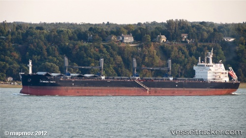
Common Faith
Current StatusWhere is the vessel?
Common Faith is currently in Near PUNTA DEL ESTE, based on AIS data received about 1h ago.
Latest AIS update:
Current position: 35.07468° S, 54.83837° W (Near PUNTA DEL ESTE)
Average speed (last 7 days): Loading…
Average speed (last 30 days): Loading…
Vessel profile: Common Faith is a Bulk Carrier with dimensions 32m x 190m.
This page combines live AIS, route history, probable destination signals, nearby traffic, and port activity for practical vessel monitoring.
The current position of vessel Common Faith is -35.07468 lat / -54.83837 lng. Updated: 2026-05-13 22:46:27 UTCNearest reference points:
- 21 nm E of PUNTA DEL ESTE
- 12 nm S of Piriápolis
- 75 nm SE of LA PALOMA
Details:
Live Vessel Common Faith Analytics (details, animations, etc.)
Recent AIS points (UTC):
2026-05-13 19:37:10 UTC · -35.00460, -54.41882 · SOG 7.1 kn · COG 240°2026-05-13 19:53:21 UTC · -35.02216, -54.45201 · SOG 7.3 kn · COG 236°
2026-05-13 21:48:31 UTC · -35.07229, -54.70124 · SOG 6.6 kn · COG 262°
2026-05-13 22:46:27 UTC · -35.07468, -54.83837 · SOG 7.9 kn · COG 264°