 vesseltracker.com
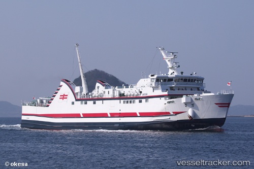
Manyou
Current StatusWhere is the vessel?
Manyou is currently in Near FUKABORI, based on AIS data received about 1h ago.
Latest AIS update:
Current position: 32.72520° N, 129.70070° E (Near FUKABORI)
Average speed (last 7 days): Loading…
Average speed (last 30 days): Loading…
Vessel profile: Manyou is a Passenger Ro Ro Cargo Ship with dimensions 15m x 87m.
This page combines live AIS, route history, probable destination signals, nearby traffic, and port activity for practical vessel monitoring.
The current position of vessel Manyou is 32.72520 lat / 129.70070 lng. Updated: 2026-04-30 10:17:35 UTCNearest reference points:
- Near FUKABORI
- Near MATSUSHIMA
- Near Fukushima, Nagasaki
Details:
Live Vessel Manyou Analytics (details, animations, etc.)
Recent AIS points (UTC):
2026-04-30 07:06:23 UTC · 32.71824, 128.87418 · SOG 15.2 kn · COG 231°2026-04-30 07:06:23 UTC · 32.71824, 128.87418 · SOG 15.2 kn · COG 231°
2026-04-30 09:42:29 UTC · 32.70935, 129.49408 · SOG 18.1 kn · COG 85°
2026-04-30 10:17:35 UTC · 32.72520, 129.70070 · SOG 18 kn · COG 90°