 vesseltracker.com
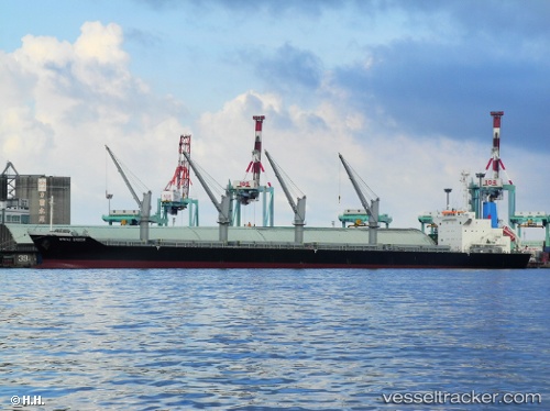
 S BOUND
Current Status
Where is the vessel?
S BOUND is currently in Near Pasadena, based on AIS data received less than 1h ago.
Latest AIS update:
Current position: 29.74343° N, 95.10712° W (Near Pasadena)
Average speed (last 7 days): Loading…
Average speed (last 30 days): Loading…
Vessel profile: S BOUND is a Bulk Carrier with dimensions m x m.
This page combines live AIS, route history, probable destination signals, nearby traffic, and port activity for practical vessel monitoring.
The current position of vessel S BOUND is 29.74343 lat / -95.10712 lng. Updated: 2026-05-15 01:23:44 UTCNearest reference points:
- Near Jacinto City
- Near Morgan Point
- Near Pasadena
Currently sailing under the flag of Marshall Islands ![]()
Details:
Live Vessel S BOUND Analytics (details, animations, etc.)
Recent AIS points (UTC):
2026-05-14 22:02:43 UTC · 29.74343, -95.10709 · SOG 0 kn · COG 58°2026-05-14 22:08:51 UTC · 29.74344, -95.10710 · SOG 0 kn · COG 58°
2026-05-15 00:20:44 UTC · 29.74344, -95.10711 · SOG 0 kn · COG 58°
2026-05-15 01:23:44 UTC · 29.74343, -95.10712 · SOG 0 kn · COG 58°