 vesseltracker.com
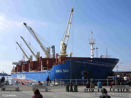
 JAMES BAY
Current Status
Where is the vessel?
JAMES BAY is currently in Near Vila do Conde Pt/Barcarena, based on AIS data received less than 1h ago.
Latest AIS update:
Current position: 1.47825° S, 48.76485° W (Near Vila do Conde Pt/Barcarena)
Average speed (last 7 days): Loading…
Average speed (last 30 days): Loading…
Vessel profile: JAMES BAY is a Cargo with dimensions m x m.
This page combines live AIS, route history, probable destination signals, nearby traffic, and port activity for practical vessel monitoring.
The current position of vessel JAMES BAY is -1.47825 lat / -48.76485 lng. Updated: 2026-05-14 12:12:35 UTCNearest reference points:
- Near Belem
- 55 nm N of Tucuma
- 70 nm N of Tucuma
Currently sailing under the flag of Singapore ![]()
Details:
Live Vessel JAMES BAY Analytics (details, animations, etc.)
Recent AIS points (UTC):
2026-05-14 07:39:37 UTC · -1.47581, -48.76229 · SOG 0.1 kn · COG 228°2026-05-14 10:12:36 UTC · -1.47818, -48.76335 · SOG 0.3 kn · COG 338°
2026-05-14 10:18:35 UTC · -1.47818, -48.76383 · SOG 0.3 kn · COG 357°
2026-05-14 12:12:35 UTC · -1.47825, -48.76485 · SOG 0.1 kn · COG 61°