 vesseltracker.com
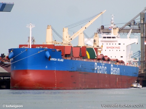
 BARROW ISLAND
Current Status
Where is the vessel?
BARROW ISLAND is currently in Near Tema, based on AIS data received about 1h ago.
Latest AIS update:
Current position: 5.53741° N, 0.01602° E (Near Tema)
Average speed (last 7 days): Loading…
Average speed (last 30 days): Loading…
Vessel profile: BARROW ISLAND is a Bulk Carrier with dimensions m x m.
This page combines live AIS, route history, probable destination signals, nearby traffic, and port activity for practical vessel monitoring.
The current position of vessel BARROW ISLAND is 5.53741 lat / 0.01602 lng. Updated: 2026-04-24 15:44:19 UTCNearest reference points:
- Near Ablogamé
- Near Sekondi
- Near Takoradi
Currently sailing under the flag of Singapore ![]()
Details:
Live Vessel BARROW ISLAND Analytics (details, animations, etc.)
Recent AIS points (UTC):
2026-04-24 11:38:20 UTC · 5.53731, 0.01596 · SOG 0.3 kn · COG 229°2026-04-24 13:08:18 UTC · 5.53735, 0.01605 · SOG 0.2 kn · COG 226°
2026-04-24 13:50:21 UTC · 5.53738, 0.01604 · SOG 0.3 kn · COG 225°
2026-04-24 15:44:19 UTC · 5.53741, 0.01602 · SOG 0.1 kn · COG 222°