 vesseltracker.com
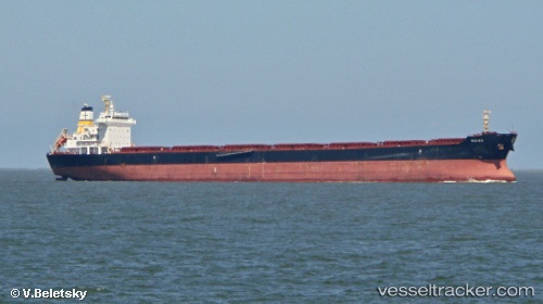
 Naias
Naias
Current Status
Where is the vessel?
Naias is currently in 26 nm N of PORT DOUGLAS, based on AIS data received about 1h ago.
Latest AIS update:
Current position: 16.05221° S, 145.50259° E (26 nm N of PORT DOUGLAS)
Average speed (last 7 days): Loading…
Average speed (last 30 days): Loading…
Vessel profile: Naias is a Bulk Carrier with dimensions 229m x 32m.
This page combines live AIS, route history, probable destination signals, nearby traffic, and port activity for practical vessel monitoring.
The current position of vessel Naias is -16.05221 lat / 145.50259 lng. Updated: 2026-05-14 07:43:56 UTCNearest reference points:
- Near CAIRNS
Currently sailing under the flag of Cyprus ![]()
Naias built in 2012 year
Deadweight:
81852 tDetails:
Live Vessel Naias Analytics (details, animations, etc.)
Recent AIS points (UTC):
2026-05-14 04:21:48 UTC · -15.38157, 145.38461 · SOG 12.8 kn · COG 181°2026-05-14 06:15:36 UTC · -15.77075, 145.40298 · SOG 12.1 kn · COG 162°
2026-05-14 07:40:34 UTC · -16.04095, 145.49873 · SOG 12 kn · COG 163°
2026-05-14 07:43:56 UTC · -16.05221, 145.50259 · SOG 11.9 kn · COG 163°