 vesseltracker.com
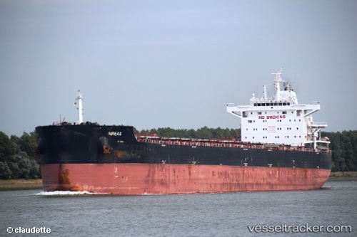
 Nireas
Current Status
Where is the vessel?
Nireas is currently in 15 nm E of Boboras, based on AIS data received about 1h ago.
Latest AIS update:
Current position: 46.52425° N, 7.78307° W (15 nm E of Boboras)
Average speed (last 7 days): Loading…
Average speed (last 30 days): Loading…
Vessel profile: Nireas is a Bulk Carrier with dimensions 229m x 32m.
This page combines live AIS, route history, probable destination signals, nearby traffic, and port activity for practical vessel monitoring.
The current position of vessel Nireas is 46.52425 lat / -7.78307 lng. Updated: 2026-04-27 04:52:01 UTCNearest reference points:
- 58 nm SE of Rietheim-Weilheim
- 57 nm S of Boboras
- 60 nm SE of San Clodio
Currently sailing under the flag of Liberia ![]()
Nireas built in 2012 year
Deadweight:
82067 tDetails:
Live Vessel Nireas Analytics (details, animations, etc.)
Recent AIS points (UTC):
2026-04-27 01:33:01 UTC · 46.05500, -8.20667 · SOG 10 kn · COG -1°2026-04-27 01:41:58 UTC · 46.07667, -8.18667 · SOG 10 kn · COG -1°
2026-04-27 03:45:20 UTC · 46.36330, -7.91970 · SOG 9.8 kn · COG 35°
2026-04-27 04:52:01 UTC · 46.52425, -7.78307 · SOG 10.4 kn · COG 30°