 vesseltracker.com
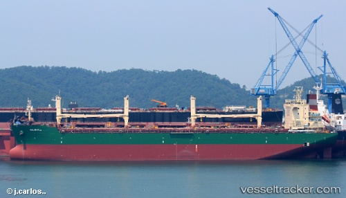
Halophyla
Current StatusWhere is the vessel?
Halophyla is currently in Near Atreco, based on AIS data received about 2h ago.
Latest AIS update:
Current position: 29.97984° N, 93.86808° W (Near Atreco)
Average speed (last 7 days): Loading…
Average speed (last 30 days): Loading…
Vessel profile: Halophyla is a General Cargo Ship with dimensions 32m x 200m.
This page combines live AIS, route history, probable destination signals, nearby traffic, and port activity for practical vessel monitoring.
The current position of vessel Halophyla is 29.97984 lat / -93.86808 lng. Updated: 2026-05-14 13:27:38 UTCNearest reference points:
- Near Atreco
- Near SUNOCO LOGISTICS
- Near Dowling
Details:
Live Vessel Halophyla Analytics (details, animations, etc.)
Recent AIS points (UTC):
2026-05-14 11:18:58 UTC · 29.76077, -93.90293 · SOG 8.4 kn · COG 292°2026-05-14 11:45:29 UTC · 29.80592, -93.95474 · SOG 7.9 kn · COG 344°
2026-05-14 13:09:58 UTC · 29.95080, -93.86124 · SOG 8 kn · COG 22°
2026-05-14 13:27:38 UTC · 29.97984, -93.86808 · SOG 6.3 kn · COG 285°