 vesseltracker.com
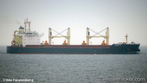
 SHUO LONG 618
Current Status
Where is the vessel?
SHUO LONG 618 is currently in Near Fujairah, based on AIS data received about 3d ago.
Latest AIS update:
Current position: 25.15023° N, 56.48035° E (Near Fujairah)
Average speed (last 7 days): Loading…
Average speed (last 30 days): Loading…
Vessel profile: SHUO LONG 618 is a Bulk Carrier with dimensions 187m x 32m.
This page combines live AIS, route history, probable destination signals, nearby traffic, and port activity for practical vessel monitoring.
The current position of vessel SHUO LONG 618 is 25.15023 lat / 56.48035 lng. Updated: 2026-05-11 20:17:47 UTCNearest reference points:
- Near Fujairah
- Near KHORFAKKAN
- Near Offshore Fujairah
Currently sailing under the flag of China Peopless Republic ![]()
SHUO LONG 618 built in 2011 year
Deadweight:
55625 tDetails:
Live Vessel SHUO LONG 618 Analytics (details, animations, etc.)
Recent AIS points (UTC):
2026-05-11 09:35:59 UTC · 25.14677, 56.47927 · SOG 4 kn · COG 43°2026-05-11 20:17:47 UTC · 25.15023, 56.48035 · SOG 0 kn · COG 160°
2026-05-11 20:17:47 UTC · 25.15023, 56.48035 · SOG 0 kn · COG 160°
2026-05-11 20:17:47 UTC · 25.15023, 56.48035 · SOG 0 kn · COG 160°