 vesseltracker.com
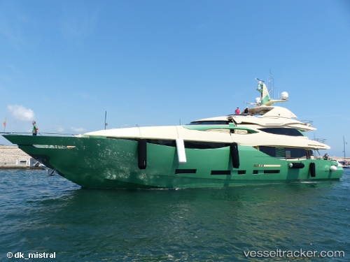
 Almaha
Current Status
Where is the vessel?
Almaha is currently in Near FLISVOS, based on AIS data received about 2h ago.
Latest AIS update:
Current position: 37.93163° N, 23.68015° E (Near FLISVOS)
Average speed (last 7 days): Loading…
Average speed (last 30 days): Loading…
Vessel profile: Almaha is a Service Ship with dimensions 40m x 10m.
This page combines live AIS, route history, probable destination signals, nearby traffic, and port activity for practical vessel monitoring.
The current position of vessel Almaha is 37.93163 lat / 23.68015 lng. Updated: 2026-04-27 11:27:13 UTCNearest reference points:
- Near FLISVOS
- Near ZEA
- Near ALIMOS
Currently sailing under the flag of Cayman Is ![]()
Details:
Live Vessel Almaha Analytics (details, animations, etc.)
Recent AIS points (UTC):
2026-04-27 07:45:11 UTC · 37.93164, 23.68014 · SOG 0 kn · COG 62°2026-04-27 09:52:10 UTC · 37.93165, 23.68015 · SOG 0 kn · COG 63°
2026-04-27 10:10:09 UTC · 37.93164, 23.68012 · SOG 0 kn · COG 62°
2026-04-27 11:27:13 UTC · 37.93163, 23.68015 · SOG 0 kn · COG 62°