 vesseltracker.com
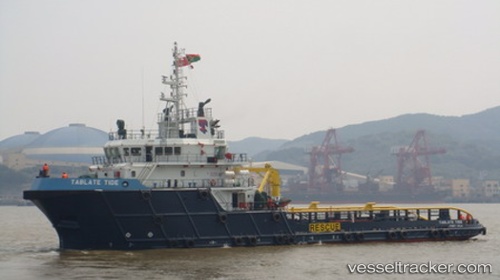
Tablate Tide
Current StatusWhere is the vessel?
Tablate Tide is currently in 34 nm E of Bandar Al Mishab, based on AIS data received less than 1h ago.
Latest AIS update:
Current position: 28.10667° N, 49.35500° E (34 nm E of Bandar Al Mishab)
Average speed (last 7 days): Loading…
Average speed (last 30 days): Loading…
Vessel profile: Tablate Tide is a Offshore Tug Supply Ship with dimensions 14m x 59m.
This page combines live AIS, route history, probable destination signals, nearby traffic, and port activity for practical vessel monitoring.
The current position of vessel Tablate Tide is 28.10667 lat / 49.35500 lng. Updated: 2026-05-13 22:03:02 UTCNearest reference points:
- 29 nm E of Bandar Al Mishab
- 26 nm E of Bandar Al Mishab
- 41 nm NE of Ras Al Khair
Details:
Live Vessel Tablate Tide Analytics (details, animations, etc.)
Recent AIS points (UTC):
2026-05-13 17:54:02 UTC · 27.75167, 49.08833 · SOG 7 kn · COG -1°2026-05-13 19:33:02 UTC · 27.83000, 49.28833 · SOG 7 kn · COG -1°
2026-05-13 19:51:04 UTC · 27.85833, 49.31333 · SOG 6 kn · COG -1°
2026-05-13 22:03:02 UTC · 28.10667, 49.35500 · SOG 7 kn · COG -1°