 vesseltracker.com
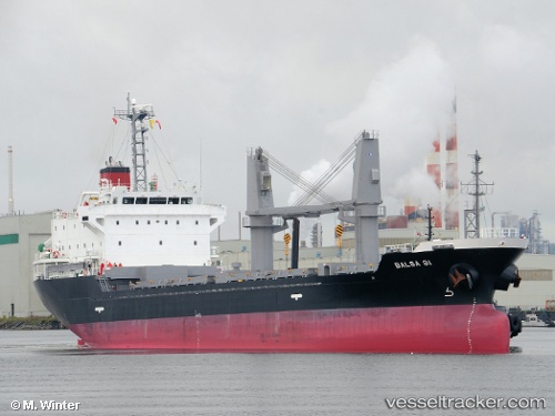
Balsa 91
Current StatusWhere is the vessel?
Balsa 91 is currently in Near Kingston, based on AIS data received less than 1h ago.
Latest AIS update:
Current position: 17.96805° N, 76.80791° W (Near Kingston)
Average speed (last 7 days): Loading…
Average speed (last 30 days): Loading…
Vessel profile: Balsa 91 is a General Cargo Ship with dimensions 19m x 106m.
This page combines live AIS, route history, probable destination signals, nearby traffic, and port activity for practical vessel monitoring.
The current position of vessel Balsa 91 is 17.96805 lat / -76.80791 lng. Updated: 2026-05-17 22:10:39 UTCNearest reference points:
- 16 nm SE of Ceiba Hueca
Details:
Live Vessel Balsa 91 Analytics (details, animations, etc.)
Recent AIS points (UTC):
2026-05-17 17:16:41 UTC · 17.96823, -76.80808 · SOG 0 kn · COG 130°2026-05-17 19:43:40 UTC · 17.96806, -76.80785 · SOG 0 kn · COG 130°
2026-05-17 20:10:40 UTC · 17.96809, -76.80792 · SOG 0 kn · COG 130°
2026-05-17 22:10:39 UTC · 17.96805, -76.80791 · SOG 0 kn · COG 130°