 vesseltracker.com
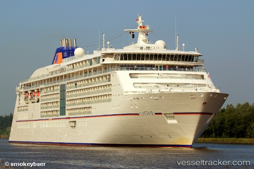
 Europa 2
Current Status
Where is the vessel?
Europa 2 is currently in Near Funchal, based on AIS data received about 2h ago.
Latest AIS update:
Current position: 32.64167° N, 16.91167° W (Near Funchal)
Average speed (last 7 days): Loading…
Average speed (last 30 days): Loading…
Vessel profile: Europa 2 is a Cruise Ship with dimensions 226m x 226m.
This page combines live AIS, route history, probable destination signals, nearby traffic, and port activity for practical vessel monitoring.
The current position of vessel Europa 2 is 32.64167 lat / -16.91167 lng. Updated: 2026-04-25 01:32:34 UTCNearest reference points:
- 121 nm N of Bañaderos
- 120 nm N of Bañaderos
- 78 nm W of Nedroma
Currently sailing under the flag of Malta ![]()
Europa 2 built in 2013 year
Deadweight:
5285 tDetails:
Live Vessel Europa 2 Analytics (details, animations, etc.)
Recent AIS points (UTC):
2026-04-24 22:41:14 UTC · 32.64208, -16.91185 · SOG 0 kn · COG 80°2026-04-24 23:53:19 UTC · 32.64167, -16.91167 · SOG 0 kn · COG -1°
2026-04-25 01:32:13 UTC · 32.64203, -16.91185 · SOG 0 kn · COG 80°
2026-04-25 01:32:34 UTC · 32.64167, -16.91167 · SOG 0 kn · COG -1°