 vesseltracker.com
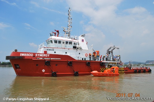
 OFCO SYNERGY
Current Status
Where is the vessel?
OFCO SYNERGY is currently in Near Mina Zayed/Abu Dhabi, based on AIS data received about 10h ago.
Latest AIS update:
Current position: 24.51625° N, 54.36657° E (Near Mina Zayed/Abu Dhabi)
Average speed (last 7 days): Loading…
Average speed (last 30 days): Loading…
Vessel profile: OFCO SYNERGY is a Offshore Tug/Supply Ship with dimensions 41m x 10m.
This page combines live AIS, route history, probable destination signals, nearby traffic, and port activity for practical vessel monitoring.
The current position of vessel OFCO SYNERGY is 24.51625 lat / 54.36657 lng. Updated: 2026-05-13 18:16:26 UTCNearest reference points:
- Near Esnnad
- Near KHALIFA
- 16 nm NW of Jebel Ali
Currently sailing under the flag of St Vincent and Grenadines ![]()
OFCO SYNERGY built in 2011 year
Deadweight:
100 tDetails:
Live Vessel OFCO SYNERGY Analytics (details, animations, etc.)
Recent AIS points (UTC):
2026-05-13 18:16:26 UTC · 24.51625, 54.36657 · SOG 0 kn · COG 142°2026-05-13 18:16:26 UTC · 24.51625, 54.36657 · SOG 0 kn · COG 142°
2026-05-13 18:16:26 UTC · 24.51625, 54.36657 · SOG 0 kn · COG 142°
2026-05-13 18:16:26 UTC · 24.51625, 54.36657 · SOG 0 kn · COG 142°