 vesseltracker.com
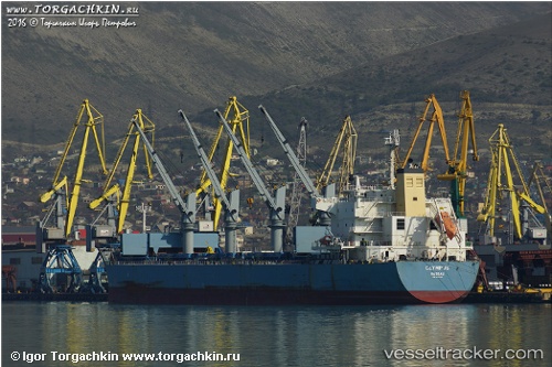
 TRIDENT UNITY
Current Status
Where is the vessel?
TRIDENT UNITY is currently in 10 nm NW of Nipah, based on AIS data received less than 1h ago.
Latest AIS update:
Current position: 1.19094° N, 103.40026° E (10 nm NW of Nipah)
Average speed (last 7 days): Loading…
Average speed (last 30 days): Loading…
Vessel profile: TRIDENT UNITY is a Bulk Carrier with dimensions m x m.
This page combines live AIS, route history, probable destination signals, nearby traffic, and port activity for practical vessel monitoring.
The current position of vessel TRIDENT UNITY is 1.19094 lat / 103.40026 lng. Updated: 2026-05-14 12:21:07 UTCNearest reference points:
- Near Tanjungbalai
- Near Nipah
- 15 nm W of Tanjong Bin
Currently sailing under the flag of Portugal ![]()
Details:
Live Vessel TRIDENT UNITY Analytics (details, animations, etc.)
Recent AIS points (UTC):
2026-05-14 07:56:37 UTC · 1.68506, 102.66952 · SOG 11.2 kn · COG 116°2026-05-14 09:22:27 UTC · 1.54672, 102.90977 · SOG 11.9 kn · COG 123°
2026-05-14 10:44:56 UTC · 1.39791, 103.14710 · SOG 12.3 kn · COG 121°
2026-05-14 12:21:07 UTC · 1.19094, 103.40026 · SOG 12 kn · COG 129°