 vesseltracker.com
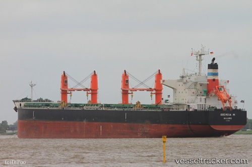
 Georgia M
Current Status
Where is the vessel?
Georgia M is currently in 32 nm S of Port Saint John's, based on AIS data received less than 1h ago.
Latest AIS update:
Current position: 32.13754° S, 29.34308° E (32 nm S of Port Saint John's)
Average speed (last 7 days): Loading…
Average speed (last 30 days): Loading…
Vessel profile: Georgia M is a Bulk Carrier with dimensions 197m x 197m.
This page combines live AIS, route history, probable destination signals, nearby traffic, and port activity for practical vessel monitoring.
The current position of vessel Georgia M is -32.13754 lat / 29.34308 lng. Updated: 2026-05-13 21:32:04 UTCNearest reference points:
- 23 nm E of Port Saint John's
- Near Island View
- Near Durban
Currently sailing under the flag of Marshall Is ![]()
Georgia M built in 2012 year
Deadweight:
58666 tDetails:
Live Vessel Georgia M Analytics (details, animations, etc.)
Recent AIS points (UTC):
2026-05-13 18:20:22 UTC · -31.94449, 29.61922 · SOG 5 kn · COG 230°2026-05-13 19:16:32 UTC · -31.99231, 29.54194 · SOG 4.7 kn · COG 226°
2026-05-13 20:16:31 UTC · -32.05149, 29.45752 · SOG 5.6 kn · COG 225°
2026-05-13 21:32:04 UTC · -32.13754, 29.34308 · SOG 6.6 kn · COG 222°