 vesseltracker.com
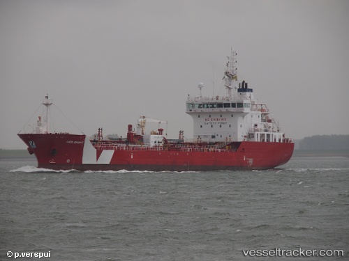
 Iver Bright
Current Status
Where is the vessel?
Iver Bright is currently in Near DETROIT, based on AIS data received about 3h ago.
Latest AIS update:
Current position: 42.30239° N, 83.08899° W (Near DETROIT)
Average speed (last 7 days): Loading…
Average speed (last 30 days): Loading…
Vessel profile: Iver Bright is a Bitumen Tanker with dimensions 111m x 18m.
This page combines live AIS, route history, probable destination signals, nearby traffic, and port activity for practical vessel monitoring.
The current position of vessel Iver Bright is 42.30239 lat / -83.08899 lng. Updated: 2026-05-14 23:33:35 UTCNearest reference points:
- Near Walkerville
- Near Saint Clair Shores
- Near Scudder
Currently sailing under the flag of Netherlands ![]()
Iver Bright built in 2012 year
Deadweight:
6265 tDetails:
Live Vessel Iver Bright Analytics (details, animations, etc.)
Recent AIS points (UTC):
2026-05-14 19:45:35 UTC · 42.30045, -83.09080 · SOG 0 kn · COG 34°2026-05-14 21:48:35 UTC · 42.30240, -83.08902 · SOG 0 kn · COG 34°
2026-05-14 23:09:37 UTC · 42.30239, -83.08900 · SOG 0.1 kn · COG 34°
2026-05-14 23:33:35 UTC · 42.30239, -83.08899 · SOG 0 kn · COG 34°