 vesseltracker.com
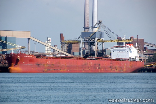
 NIRIIS
Current Status
Where is the vessel?
NIRIIS is currently in Near Diliskelesi, based on AIS data received about 2h ago.
Latest AIS update:
Current position: 40.76354° N, 29.52864° E (Near Diliskelesi)
Average speed (last 7 days): Loading…
Average speed (last 30 days): Loading…
Vessel profile: NIRIIS is a Bulk Carrier with dimensions m x m.
This page combines live AIS, route history, probable destination signals, nearby traffic, and port activity for practical vessel monitoring.
The current position of vessel NIRIIS is 40.76354 lat / 29.52864 lng. Updated: 2026-05-14 10:04:08 UTCNearest reference points:
- Near Yilport
- Near YALOVA
- Near Diliskelesi
Currently sailing under the flag of Marshall Islands ![]()
Details:
Live Vessel NIRIIS Analytics (details, animations, etc.)
Recent AIS points (UTC):
2026-05-14 07:22:07 UTC · 40.76351, 29.52863 · SOG 0 kn · COG 90°2026-05-14 07:25:08 UTC · 40.76353, 29.52866 · SOG 0 kn · COG 90°
2026-05-14 09:34:08 UTC · 40.76352, 29.52866 · SOG 0 kn · COG 90°
2026-05-14 10:04:08 UTC · 40.76354, 29.52864 · SOG 0 kn · COG 90°