 vesseltracker.com
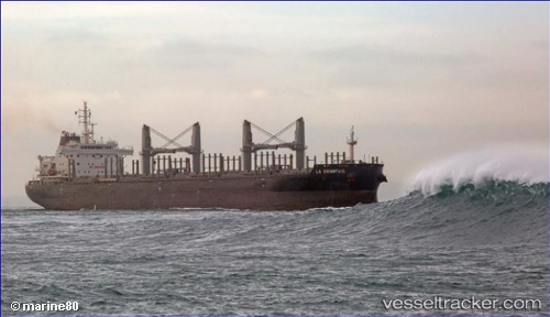
 AFRICAN CORMORANT
Current Status
Where is the vessel?
AFRICAN CORMORANT is currently in 54 nm E of Wolfsberg im Schwarzautal, based on AIS data received less than 1h ago.
Latest AIS update:
Current position: 49.09090° N, 158.27792° E (54 nm E of Wolfsberg im Schwarzautal)
Average speed (last 7 days): Loading…
Average speed (last 30 days): Loading…
Vessel profile: AFRICAN CORMORANT is a Bulk Carrier with dimensions 180m x 180m.
This page combines live AIS, route history, probable destination signals, nearby traffic, and port activity for practical vessel monitoring.
The current position of vessel AFRICAN CORMORANT is 49.09090 lat / 158.27792 lng. Updated: 2026-05-01 05:52:27 UTCNearest reference points:
- 31 nm E of Severo-Kurilsk
- Near Severo-Kurilsk
- 13 nm SW of Ozernovskiy
Currently sailing under the flag of Bahamas ![]()
AFRICAN CORMORANT built in 2013 year
Deadweight:
40481 tDetails:
Live Vessel AFRICAN CORMORANT Analytics (details, animations, etc.)
Recent AIS points (UTC):
2026-05-01 01:35:15 UTC · 48.63500, 157.32167 · SOG 11 kn · COG -1°2026-05-01 04:02:27 UTC · 48.90173, 157.87247 · SOG 11 kn · COG 56°
2026-05-01 04:02:27 UTC · 48.90173, 157.87247 · SOG 11 kn · COG 56°
2026-05-01 05:52:27 UTC · 49.09090, 158.27792 · SOG 11 kn · COG 61°