 vesseltracker.com
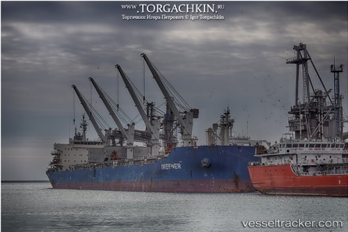
Greener
Current StatusWhere is the vessel?
Greener is currently in Near Port Elizabeth, based on AIS data received less than 1h ago.
Latest AIS update:
Current position: 33.85721° S, 25.79257° E (Near Port Elizabeth)
Average speed (last 7 days): Loading…
Average speed (last 30 days): Loading…
Vessel profile: Greener is a Bulk Carrier with dimensions 32m x 189m.
This page combines live AIS, route history, probable destination signals, nearby traffic, and port activity for practical vessel monitoring.
The current position of vessel Greener is -33.85721 lat / 25.79257 lng. Updated: 2026-05-14 03:51:16 UTCNearest reference points:
- Near Deal Party
- 21 nm S of Mount Pleasant
Details:
Live Vessel Greener Analytics (details, animations, etc.)
Recent AIS points (UTC):
2026-05-14 00:15:18 UTC · -33.85654, 25.79290 · SOG 0.4 kn · COG 245°2026-05-14 01:33:19 UTC · -33.85751, 25.79258 · SOG 0.4 kn · COG 260°
2026-05-14 02:09:15 UTC · -33.85800, 25.79246 · SOG 0.5 kn · COG 272°
2026-05-14 03:51:16 UTC · -33.85721, 25.79257 · SOG 0.5 kn · COG 264°