 vesseltracker.com
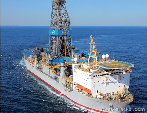
Noble Don Taylor
Current StatusWhere is the vessel?
Noble Don Taylor is currently in 89 nm NE of Enmore, based on AIS data received less than 1h ago.
Latest AIS update:
Current position: 7.95744° N, 57.09427° W (89 nm NE of Enmore)
Average speed (last 7 days): Loading…
Average speed (last 30 days): Loading…
Vessel profile: Noble Don Taylor is a Drilling Ship with dimensions 36m x 229m.
This page combines live AIS, route history, probable destination signals, nearby traffic, and port activity for practical vessel monitoring.
The current position of vessel Noble Don Taylor is 7.95744 lat / -57.09427 lng. Updated: 2026-04-29 16:44:50 UTCNearest reference points:
- 57 nm NE of Adventure
- 38 nm NW of Jarikaba
- Near Paramaribo Zorg en Hoop Airport
Details:
Live Vessel Noble Don Taylor Analytics (details, animations, etc.)
Recent AIS points (UTC):
2026-04-29 13:13:59 UTC · 7.95748, -57.09428 · SOG 0 kn · COG 90°2026-04-29 13:54:38 UTC · 7.95745, -57.09429 · SOG 0 kn · COG 89°
2026-04-29 15:40:01 UTC · 7.95743, -57.09430 · SOG 0 kn · COG 90°
2026-04-29 16:44:50 UTC · 7.95744, -57.09427 · SOG 0 kn · COG 89°