 vesseltracker.com
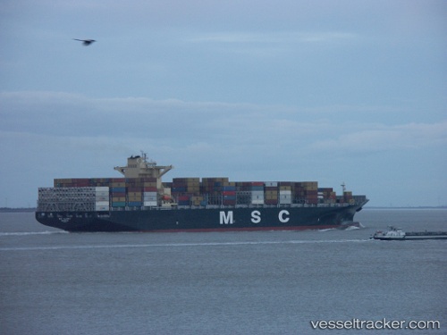
 Msc Albany
Current Status
Where is the vessel?
Msc Albany is currently in Near Suape, based on AIS data received less than 1h ago.
Latest AIS update:
Current position: 8.39272° S, 34.96531° W (Near Suape)
Average speed (last 7 days): Loading…
Average speed (last 30 days): Loading…
Vessel profile: Msc Albany is a Container Ship with dimensions 299m x 299m.
This page combines live AIS, route history, probable destination signals, nearby traffic, and port activity for practical vessel monitoring.
The current position of vessel Msc Albany is -8.39272 lat / -34.96531 lng. Updated: 2026-05-14 22:23:49 UTCNearest reference points:
- Near Suape
- Near Boa Viagem
- Near Barra dos Coqueiros
Currently sailing under the flag of Liberia ![]()
Msc Albany built in 2013 year
Deadweight:
112516 tDetails:
Live Vessel Msc Albany Analytics (details, animations, etc.)
Recent AIS points (UTC):
2026-05-14 19:26:49 UTC · -8.39274, -34.96529 · SOG 0 kn · COG 293°2026-05-14 19:44:51 UTC · -8.39275, -34.96534 · SOG 0 kn · COG 293°
2026-05-14 21:38:51 UTC · -8.39275, -34.96534 · SOG 0 kn · COG 293°
2026-05-14 22:23:49 UTC · -8.39272, -34.96531 · SOG 0 kn · COG 293°