 vesseltracker.com
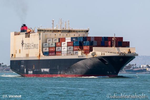
Marjorie C.
Current StatusWhere is the vessel?
Marjorie C. is currently in Near Coronado, based on AIS data received less than 1h ago.
Latest AIS update:
Current position: 32.64852° N, 117.11519° W (Near Coronado)
Average speed (last 7 days): Loading…
Average speed (last 30 days): Loading…
Vessel profile: Marjorie C. is a Ro Ro Cargo Ship with dimensions 32m x 210m.
This page combines live AIS, route history, probable destination signals, nearby traffic, and port activity for practical vessel monitoring.
The current position of vessel Marjorie C. is 32.64852 lat / -117.11519 lng. Updated: 2026-05-18 06:25:22 UTCNearest reference points:
- Near San Diego
- Near Coronado
- Near Ocean Beach
Details:
Live Vessel Marjorie C. Analytics (details, animations, etc.)
Recent AIS points (UTC):
2026-05-18 01:52:54 UTC · 32.64855, -117.11521 · SOG 0 kn · COG 252°2026-05-18 03:34:21 UTC · 32.64854, -117.11531 · SOG 0 kn · COG 252°
2026-05-18 04:16:56 UTC · 32.64849, -117.11524 · SOG 0 kn · COG 252°
2026-05-18 06:25:22 UTC · 32.64852, -117.11519 · SOG 0 kn · COG 252°