 vesseltracker.com
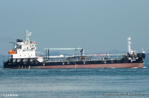
 Marine Pamela
Current Status
Where is the vessel?
Marine Pamela is currently in Near TANAH MERAH, based on AIS data received less than 1h ago.
Latest AIS update:
Current position: 1.31957° N, 104.07114° E (Near TANAH MERAH)
Average speed (last 7 days): Loading…
Average speed (last 30 days): Loading…
Vessel profile: Marine Pamela is a Service Ship with dimensions 79m x 16m.
This page combines live AIS, route history, probable destination signals, nearby traffic, and port activity for practical vessel monitoring.
The current position of vessel Marine Pamela is 1.31957 lat / 104.07114 lng. Updated: 2026-05-14 12:14:19 UTCNearest reference points:
- Near TANAH MERAH
- Near Tanjung Setapa
- Near PENGERANG
Currently sailing under the flag of Singapore ![]()
Marine Pamela built in 2012 year
Deadweight:
4993 tDetails:
Live Vessel Marine Pamela Analytics (details, animations, etc.)
Recent AIS points (UTC):
2026-05-14 07:47:13 UTC · 1.32065, 104.07378 · SOG 0.1 kn · COG 227°2026-05-14 09:17:14 UTC · 1.32098, 104.07269 · SOG 0.2 kn · COG 184°
2026-05-14 10:44:17 UTC · 1.31861, 104.07119 · SOG 0 kn · COG 75°
2026-05-14 12:14:19 UTC · 1.31957, 104.07114 · SOG 0 kn · COG 109°