 vesseltracker.com
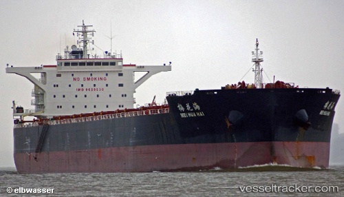
 Mei Hua Hai
Current Status
Where is the vessel?
Mei Hua Hai is currently in 27 nm NW of Port Hedland, based on AIS data received about 2h ago.
Latest AIS update:
Current position: 19.88333° S, 118.38667° E (27 nm NW of Port Hedland)
Average speed (last 7 days): Loading…
Average speed (last 30 days): Loading…
Vessel profile: Mei Hua Hai is a Bulk Carrier with dimensions 254m x 254m.
This page combines live AIS, route history, probable destination signals, nearby traffic, and port activity for practical vessel monitoring.
The current position of vessel Mei Hua Hai is -19.88333 lat / 118.38667 lng. Updated: 2026-05-14 05:37:24 UTCNearest reference points:
- 11 nm E of Port Walcot
- 116 nm NE of Mutineer
- 121 nm NE of Mutineer
Currently sailing under the flag of China ![]()
Details:
Live Vessel Mei Hua Hai Analytics (details, animations, etc.)
Recent AIS points (UTC):
2026-05-14 01:33:06 UTC · -19.88333, 118.38833 · SOG 1 kn · COG -1°2026-05-14 03:45:47 UTC · -19.88333, 118.38833 · SOG 0 kn · COG -1°
2026-05-14 04:49:11 UTC · -19.88333, 118.38667 · SOG 0 kn · COG -1°
2026-05-14 05:37:24 UTC · -19.88333, 118.38667 · SOG 0 kn · COG -1°