 vesseltracker.com
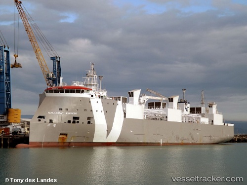
 GALLOWAY EXPRESS
Current Status
Where is the vessel?
GALLOWAY EXPRESS is currently in 40 nm W of Jorf Lasfar, based on AIS data received less than 1h ago.
Latest AIS update:
Current position: 33.19500° N, 9.41667° W (40 nm W of Jorf Lasfar)
Average speed (last 7 days): Loading…
Average speed (last 30 days): Loading…
Vessel profile: GALLOWAY EXPRESS is a Livestock Carrier with dimensions m x m.
This page combines live AIS, route history, probable destination signals, nearby traffic, and port activity for practical vessel monitoring.
The current position of vessel GALLOWAY EXPRESS is 33.19500 lat / -9.41667 lng. Updated: 2026-04-24 15:40:04 UTCNearest reference points:
- 52 nm NW of Safi
- 51 nm NW of Jorf Lasfar
- 32 nm NW of Safi
Currently sailing under the flag of Portugal ![]()
Details:
Live Vessel GALLOWAY EXPRESS Analytics (details, animations, etc.)
Recent AIS points (UTC):
2026-04-24 11:37:05 UTC · 32.53833, -10.19333 · SOG 13 kn · COG -1°2026-04-24 13:09:52 UTC · 32.80264, -9.91137 · SOG 13.4 kn · COG 46°
2026-04-24 13:52:01 UTC · 32.91000, -9.77500 · SOG 13 kn · COG -1°
2026-04-24 15:40:04 UTC · 33.19500, -9.41667 · SOG 13 kn · COG -1°