 vesseltracker.com
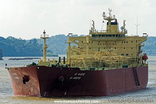
G.arete
Current StatusWhere is the vessel?
G.arete is currently in 390 nm SW of Santa Rosa Island, based on AIS data received less than 1h ago.
Latest AIS update:
Current position: 28.33576° N, 123.91868° W (390 nm SW of Santa Rosa Island)
Average speed (last 7 days): Loading…
Average speed (last 30 days): Loading…
Vessel profile: G.arete is a Lpg Tanker with dimensions 36m x 225m.
This page combines live AIS, route history, probable destination signals, nearby traffic, and port activity for practical vessel monitoring.
The current position of vessel G.arete is 28.33576 lat / -123.91868 lng. Updated: 2026-05-14 15:51:50 UTCNearest reference points:
- Open sea, approx. 404 nm off the nearest listed port
- Open sea, approx. 407 nm off the nearest listed port
- Open sea, approx. 401 nm off the nearest listed port
Details:
Live Vessel G.arete Analytics (details, animations, etc.)
Recent AIS points (UTC):
2026-05-14 12:23:06 UTC · 28.74660, -124.69012 · SOG 13.5 kn · COG 120°2026-05-14 13:48:49 UTC · 28.57701, -124.37497 · SOG 13.9 kn · COG 120°
2026-05-14 14:29:47 UTC · 28.49655, -124.22047 · SOG 13.8 kn · COG 120°
2026-05-14 15:51:50 UTC · 28.33576, -123.91868 · SOG 13.7 kn · COG 122°