 vesseltracker.com
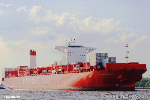
 Cap San Augustin
Current Status
Where is the vessel?
Cap San Augustin is currently in 73 nm SE of Gonubie, based on AIS data received less than 1h ago.
Latest AIS update:
Current position: 33.75833° S, 29.08667° E (73 nm SE of Gonubie)
Average speed (last 7 days): Loading…
Average speed (last 30 days): Loading…
Vessel profile: Cap San Augustin is a Container Ship with dimensions 333m x 48m.
This page combines live AIS, route history, probable destination signals, nearby traffic, and port activity for practical vessel monitoring.
The current position of vessel Cap San Augustin is -33.75833 lat / 29.08667 lng. Updated: 2026-05-14 21:37:50 UTCNearest reference points:
- 23 nm E of Port Saint John's
Currently sailing under the flag of Denmark ![]()
Cap San Augustin built in 2013 year
Deadweight:
124470 tDetails:
Live Vessel Cap San Augustin Analytics (details, animations, etc.)
Recent AIS points (UTC):
2026-05-14 18:19:13 UTC · -34.03978, 27.95240 · SOG 17.9 kn · COG 70°2026-05-14 19:34:51 UTC · -33.93833, 28.38500 · SOG 17 kn · COG -1°
2026-05-14 19:49:28 UTC · -33.92007, 28.46877 · SOG 17.7 kn · COG 71°
2026-05-14 21:37:50 UTC · -33.75833, 29.08667 · SOG 18 kn · COG -1°